Examples
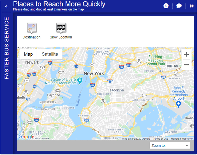
The Map Marker Screen is used to collect geo-spatial or location-based feedback from visitors.
- It can be used to identify areas of concern or where visitors would like to see changes, improvements, or resource allocation or ask where visitors currently travel to and or from.
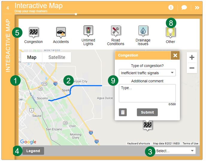
- There can be between 1 to 8 marker types so that visitors can label different locations in different categories.
- When each marker is dropped, a pop-up will appear that can feature between 1 to 5 dropdown and comment questions that can be used to collect additional information about the pin.
- If there are already identified locations or location-based projects, consider using the Project Selection Screen.
How to Build It
This Screen can contain between 1 to 8 marker types, each with a marker balloon with 1 to 5 dropdowns and an optional comment.
Content you'll need to prepare:
- The latitude/longitude center of the map
- An optional KMZ layer to display
- Optional locations to zoom in to, including a label and latitude/longitude for each
- An optional legend to display
Decisions you'll need to make:
- How many marker types to show (up to 8 markers)
- What the marker types are
- The labels for each marker type
- The icon for each marker type (choose from a MetroQuest icon library)
- If there are (up to 5) dropdowns and comment questions for each marker, and what the options are
- Whether or not there is an optional legend for the map
- Whether or not there is a locations zoom dropdown, and how many there are (1-99)
- An optional KMZ file to show a project boundary or other key project information.
Keys To Success
- Keep the number of markers to a small and manageable number. Within each, you may add up to two additional or clarifying questions to further categorize the markers. For instance, for a travel-based map, a "work" marker could have a dropdown for mode of travel and frequency. Or use the second question for providing a textbox for participants to explain their answer.
- Fewer marker types with thoughtful additional questions work better than numerous markers without additional questions.
- Participants can add as many markers as they wish, so expect a considerable amount of data from this Screen.
- If the project area is large, consider allowing participants to zoom the map to predefined locations, such as counties or neighborhoods.
- To help participants understand where input is requested, it is possible to add a project boundary (KMZ) to the map. If the KMZ is not self-explanatory, make use of the legend pop-up.