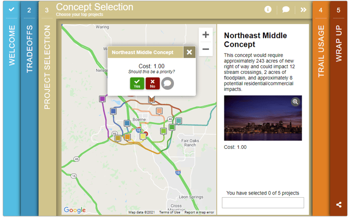
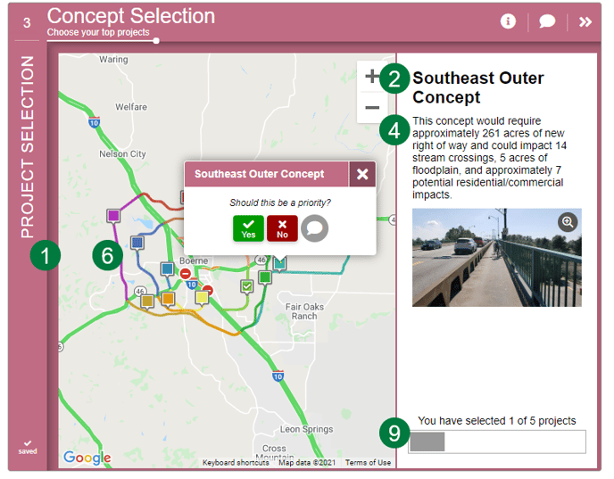
The Project Selection Screen presents a range of projects on a map and is used to collect community input on which location-based projects, that have previously identified, should be implemented.
- The map will show up to 99 projects that visitors can click on to learn more about and indicate which ones are a priority. They can also add optional comments.
- The number of projects a visitor can choose can be limited by either:
- limiting the number of projects they can select, or;
- limiting the budget by giving each project a cost
- To let visitors drop their own markers on a map, use the Map Marker screen.
- For input on a series of projects that are not location-based, consider the Strategy Rating or Image Rating Screen.
- For a more general budget exercise, consider the Budget Allocation or Funding Balance Screen.
How to Build It
This Screen can contain up to 99 projects on a map.
Content you'll need to prepare:
- The Latitude/Longitude center of the map
- Project Names for up to 99 projects
- The latitude and longitude of each project location.
- An optional image and description for each project
- An optional cost for each project
- An optional KMZ layer and map layer (Traffic, Transit, and Bicycle) for the project area
Decisions you'll need to make:
- How many projects to display, between 1 to 99 projects
- Color of the project markers
- Whether to have Limit Type or not
- Budget if each project has a cost
- Selection to limit the number of projects that can be selected
- Whether projects have images and/or descriptions
- Whether to create KMZ layer and/or use other map layers
Keys To Success
- Keep the number of projects to a small, manageable number. Otherwise, this Screen can feel overwhelming.
- Limit users to a budget (if each project has a cost) or to a total number of projects.
- Assume that many participants will focus on the projects near to where they live or work.
- This Screen is best used to indicate proposed corridors or roads for additional work. It is also possible to include point-data for projects. However, mixing line and point data might be confusing.